Historical Maps
Recent copies of two historical maps
Two significant historical maps exist of Upper Broughton. One drawn by Brett in 1833 and primarily intended as a reference to the land holdings of the Brett family. Currently the original is held by the family in New Zealand.
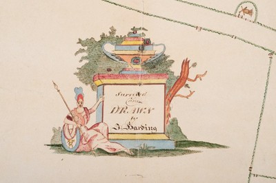
The second map pre-dates this and was drawn by Harding in approximately 1820 this exquisite map is drawn on paper from J. Whatman from their Turkey Mills and dated 1818.
You can see these maps below: